
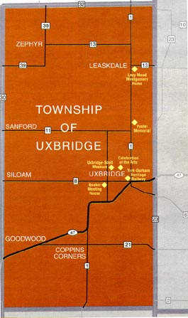
The Township of Uxbridge is located approximately 40 km northeast of Metropolitan Toronto, in the province of Ontario in Canada. The Township has the 3rd largest geographic area (41,232 hectare) of the 8 municipalities which form the Regional Municipality of Durham. However, the Township is the 2nd smallest municipality in Durham Region with a population of 19,169 in 2006, a 10.3% increase since 2006. More statistic info on Uxbridge Township.
|
Click the "+" and "-" buttons
to zoom on the map. |
| To the North | Town of Georgina |
| To the East | Townships of Brock and Scugog |
| To the South | Town of Pickering |
| To the West | Towns of Whitchurch-Stouffville and East Gwillimbury |
The focal point of the Township is the Uxbridge Urban Area. The Township also has 8 hamlets:
 |
Because of its easy commuting distance to Metro Toronto and the southern municipalities of Durham Region, the Township attracts many people who wish to live in a rural, small-town community but close to major urban centres. Uxbridge Township Map used with permission from the Regional Municipality of Durham, Economic Development & Tourism Department |

![[Uxbridge Realty]](clip_art/bars/property.gif)
Visit the Uxbridge Realty Page
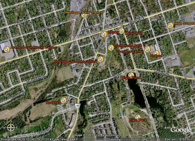
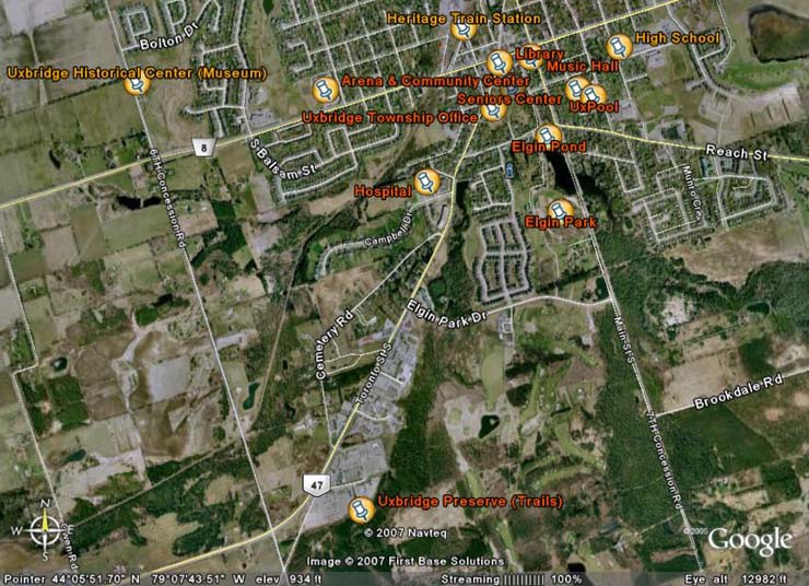
More on Community Profile in Uxbridge Township's Photo Album
![[ Home ]](buttons/home.gif)
![[ Uxbridge - The Present ]](buttons/present.gif)
![[ A Journey to the Past ]](buttons/past.gif)
![[ Photo Album ]](buttons/album.gif)
![[ What's New? ]](buttons/wnew.gif)
![[ Creative Kids ]](buttons/ckids_b.gif)